Lefroy was one of Tasmania’s most important and profitable goldfields. Originally discovered as an alluvial field, it went on to become one of the main hard-rock quartz mining fields and hosted several of Tasmania’s relatively few dividend-paying gold mines.
Back Creek, immediately to the east, is often treated in the same publications, and is arguably an extension of the Lefroy goldfield. In contrast to Lefroy’s hard-rock focus, Back Creek was overwhelmingly an alluvial field.
Was it the first discovery?
Several online sources claim that Ferdinand Riva, a Launceston jeweller, was the first to discover gold in Tasmania, in the Lefroy area, then known as Nine Mile Springs (see here, here, here and here) in 1849. These sources all seem to be quoting the 1911 yearbook in the first link (the wording in all of them is very similar), but in my opinion this claim is impossible to prove. Ferdinand Riva was indeed a quite well known Launceston jeweller and watchmaker of German origin. The first source I could find linking his name to the Lefroy goldfield is a letter to the Launceston Examiner in October 1881, and states that Riva handled ‘many pounds of gold’ from Nine Mile Springs well before the hard-rock discovery in 1869. The letter-writer (Edward Dally) states the he had found gold in 1849 himself, but had not been allowed to work it. It’s important to keep in mind that these claims were made 32 years after the events are said to have taken place. Shortly after this, in February 1882, an article in The Mercury (Hobart) reports that Riva was said to have had some rocks tested in 1847 and they were found to contain gold. Since a) this was reported as hearsay, b) nothing was done about it, c) there are no published reports at the time, and d) the claim was made 35 years later, it’s hard to take it seriously.
Many people claimed to have been the first to discover gold in Tasmania, and one at least (John Gardiner in Beaconsfield) has a more-or-less solid claim. You can see a discussion about this topic in my older post on the Mangana goldfield, which is the only one for which plenty of written evidence exists.
Gold is found
-
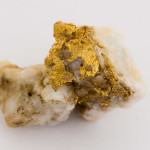
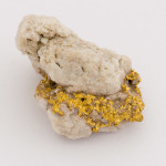
- Specimen of gold in quartz, Lefroy area
-
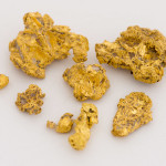
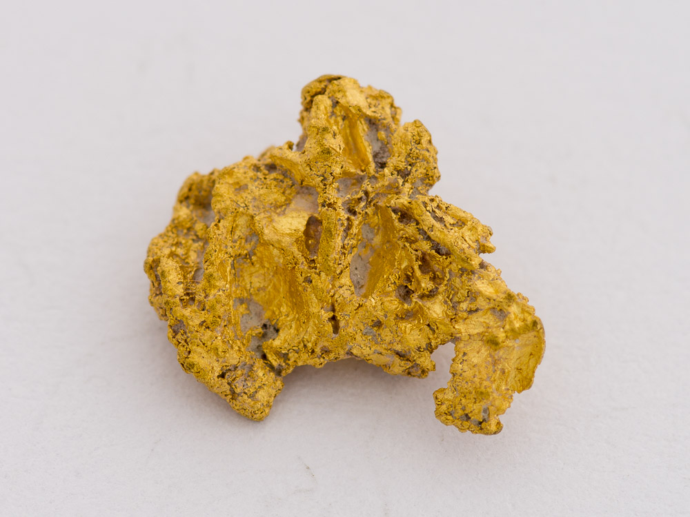
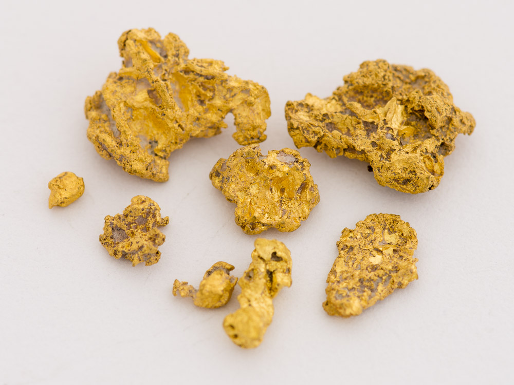
- Nuggets from the Lefroy area
-
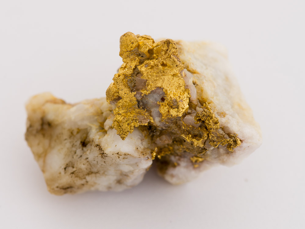
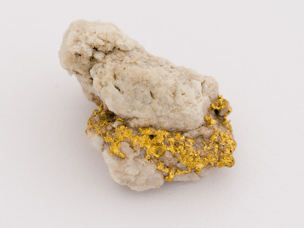
- Specimen of gold in quartz, Lefroy area
An article in the Launceston Examiner on 28 October 1858 is the first published evidence I could locate of gold at Nine Mile Springs (Lefroy). It states that the find was not surprising, as gold had been known from that locality since the previous year (1857). Nuggety gold was reportedly found, with nuggets up to 3 dwt (4.5 g) and nuggets always created more of a stir than fine gold. Interestingly, as in so many other places, naysayers appear to have been a feature of the Lefroy goldfield. One source described the gold as being present in “small and unremunerative quantities”. The find appears to be exclusively alluvial, and most sources claim 1869 as the year of the discovery of gold in Lefroy. Reports about the discovery disappeared from the newspapers shortly after.
Hard-rock mining was established in 1869, and by the 1890s the field was all but abandoned. Total production for the Lefroy goldfield from about 1870 to the end of most commercial production in 1904 was about 187,000 ounces or 5797 kg of gold.
The mines were located along a series of east-west trending, mostly north-dipping reefs or lodes that spanned from near the current bridge over New Chum Creek on the Beechford Road, down to a km or so south of the main highway, at the Londonderry reef.

Map of Lefroy goldfield from Broadhurst 1935 (see below)
The highest production came from the mines along the Pinafore and Chum reefs, on the northern end of the field, but the Volunteer reef was also a big producer, and some of the reefs in the middle of the modern township were reputedly quite rich near the surface.
Compared to other Tasmanian goldfields, the alluvial was not relatively important. Like pretty much all goldfields, the original discovery was alluvial, but relatively little alluvial gold was produced compared to hard-rock, and most of that before the time records were kept. The main alluvial areas were Poverty Lead, east of the town, Sludge Creek, south of the town, the New Chum Creek area, and the Nugget mine area near the Railway Reserve.
Back Creek
Although a few kilometers away, Back Creek is considered to be essentially an extension of the Lefroy goldfield. In contrast to the mostly hard-rock Lefroy, the gold at Back Creek was almost all alluvial.
The Back Creek goldfield was discovered in 1869, probably by miners travelling to the Waterhouse goldfield. It consists of four Tertiary shallow leads running northwest to southeast, and dipping under a basalt flow (turning into a deep lead).
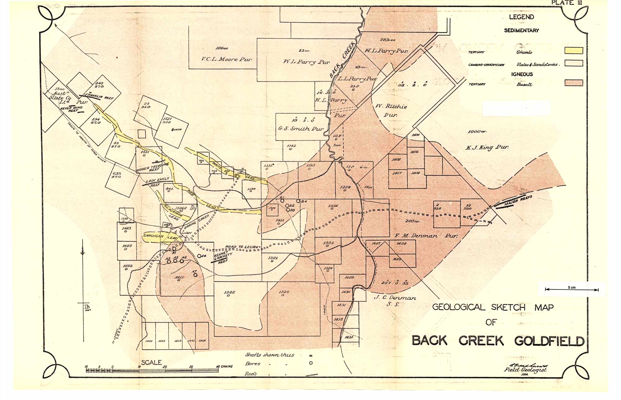
Map of Back Creek goldfield from Broadhurst 1935 (see below)
From north to south, they’re known as the White Lead, the Red Lead, Blackman’s Lead and the Cardigan Lead. The White and Red Leads are called that from the colour of the wash, which is white pipeclay in the White Lead, and iron-stained red in the Red Lead. These two had coarser, crystalline gold that hadn’t travelled very far. In contrast the Blackman’s and Cardigan leads had waterworn smaller gold.
The alluvial output of the field has been estimated at about 10,000 ounces. A couple of hard-rock mines in the area of the leads had a tiny output by comparison.
A second area to the east, where the Major and Leura mines were located, did have some reef gold production, but is entirely within private property today.
Access in the Back Creek and Lefroy goldfields
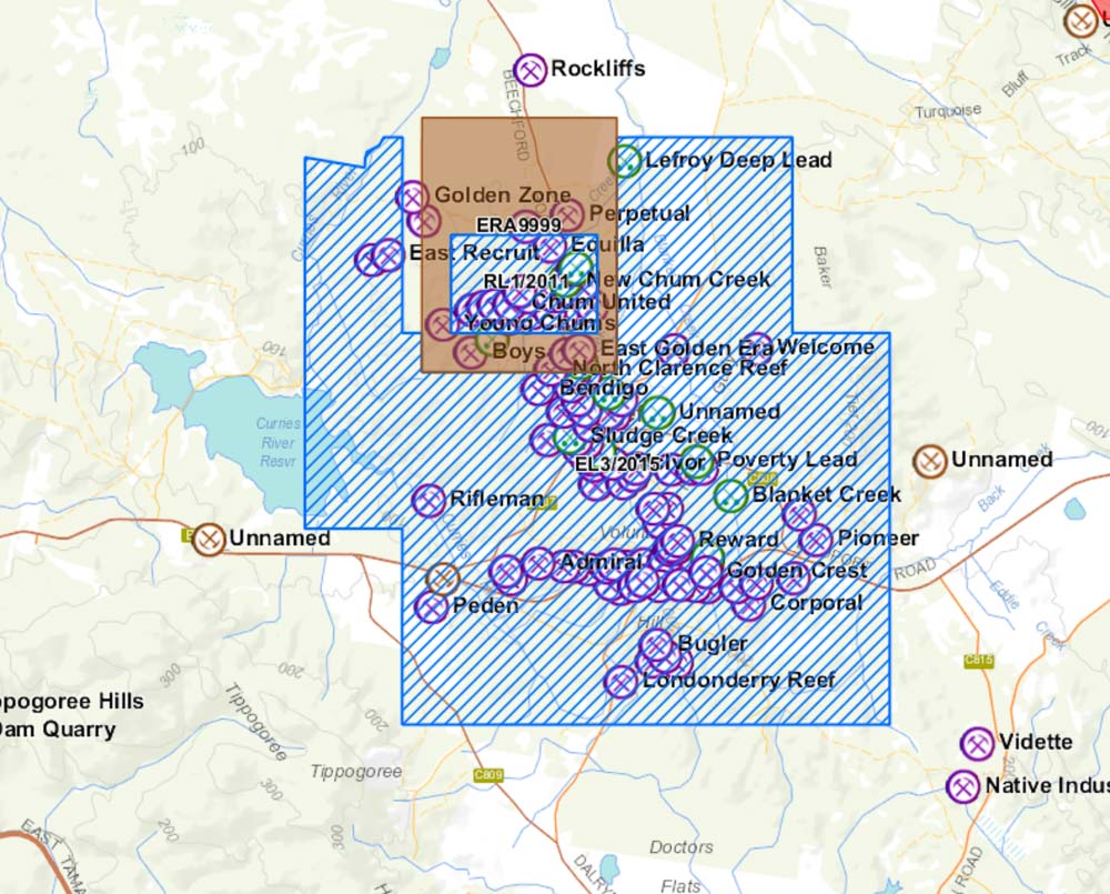
There are no dedicated Fossicking Areas in the Lefroy or Back Creek goldfields so you’ll need a prospecting licence. The Lefroy goldfield is mostly covered in current exploration licences, as of October 2015. There is a section of Exploration Release Area (ERA) which does not require permission. In the maps below, the exploration licences for metallic minerals are hashed in blue, and the ERA is coloured brown.
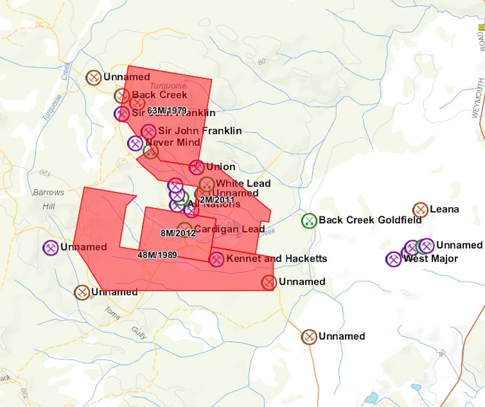
By comparison, Back Creek is mostly covered in current, active mining leases. Unlike an exploration licence, a mining lease is considered pretty much private property for all intents and purposes. While an EL holder has to have good reasons to deny you access for prospecting, there is no such a requirement for a mining lease. Getting permissions organised beforehand is of the highest importance. There is a small amount of ground along the road to the slate quarry that is free ground.
Compared to Lefroy, Back Creek contains some historical mining heritage such as old timber huts and puddlers. If detecting in the vicinity, please respect the integrity of any puddlers you may come across, and don’t dig holes in or immediately around them. There are very few left in all of Tasmania.
-
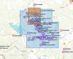
- Exploration licences and ERA over the Lefroy goldfield
-
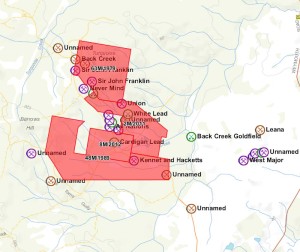
- Mining leases (red) over Back Creek goldfield
Lefroy and Back Creek references
- G. Thureau (1882) Report on the Mineral Resources and Permanency of the Lefroy Gold Field, Tasmania.
- G. Thureau (1883) Report on the Future Prospects of Deep Mining of Gold Bearing Quartz Lodes at Lefroy.
- A. Montgomery (1894) Report on the Back Creek Goldfield, County of Dorset.
- A. Montgomery (1897) Lefroy Gold field, Tasmania.
- E. Broadhurst (1935) Lefroy and Back Creek Goldfields.
- D.I. Groves (1976) Geology of the Lefroy Goldfield.
- A. Mconie (1983) A Review of the Gold Potential of North Eastern Tasmania. (BIG FILE)
Did you find this useful? If you like the content at Apple Isle Prospector, feel free to get in contact, or leave a comment. If you enjoyed this article, then let others know by sharing it on Facebook or liking our Facebook or Twitter pages:
We are in Tasmania for 6 months abd wouls love to doe somw detecting and or panning. The Lefroy and Back Creek area could be a good spot, but after reading your post above, it seems as though that is a no..no., as there are claims on these areas. Can yoe suggest anywhere else wecould go.My husband and I are at Sheffield until Saturday and then we will be coming East. We are both members of the PMAV and we bought our Tassie licence in Burnie last week.
Hope you can help. Thanks…..Ruth and Dave Manning.